
Marysville Previous Residents by Era
No single source spans every address or year. Start near the target date, then carry a parcel number, legal description, street form, or household name into the next set.
| Source | Years It Covers | Where Held | What It Shows |
|---|---|---|---|
| Recorded deeds | Mostly July 1976 to present online | Auditor–Recording Division | Transfer parties, dates, parcel and legal description |
| Older recordings | Before July 1976 | Recording office microfilm | Earlier deeds, plats, and liens |
| Marysville in Everett directories | Discontinuous 1901 to 1988 | Washington State Library | Dated name and address leads |
| Census | 1887 county and 1950 federal | Digital Archives and NARA | Household context |
| Sanborn map | 1912 | Library of Congress | Historic streets and footprints |
| Marysville Globe | 1,146 issues across 129 cataloged years | Historical Society | Named events and address clues |
Post-1976 owner work normally starts online. Earlier research shifts to microfilm, on-site volumes, maps, and newspaper images. No separate verified Marysville criss-cross run or formal house-history guide was found.
Marysville Deeds Before 1976
The recorded-document index is strongest from July 1976. It accepts name, type, recording number, date, parcel, book and page, and legal description. The web route requires an account as of March 2, 2026.
Earlier recordings are generally on microfilm in Everett. Public terminals, counter help, phone, and mail searches complete the access chain. Significant staff work and pre-1976 research may cost $8 per hour.
Read the live recording notice before using this capture.
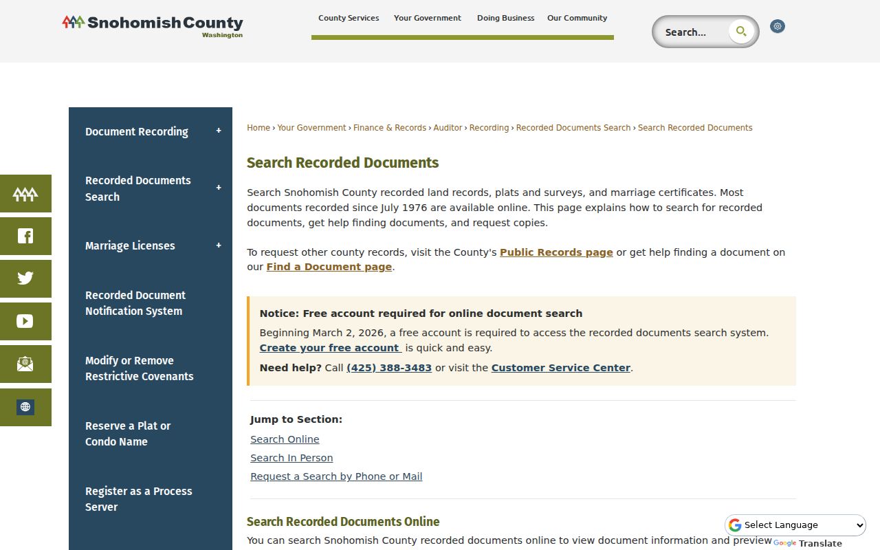
The image marks the official entry point, while office and microfilm channels carry the trail past the web cutoff.
Trace Marysville Owners Backward
Begin with the current parcel. The Assessor Property Summary supplies the owner role, parcel number, sales lead, and legal description. These facts help avoid false same-name matches.
- Copy the parcel ID and legal description from the current account.
- Find the current purchase deed and note both parties, date, and recording number.
- Search the seller as a grantee to locate that party's prior purchase.
- Repeat while the online index supports the dates.
- Take book, page, party, and land details to microfilm when the web run ends.
- Grantor / grantee
- The grantor transfers an interest; the grantee receives it.
- Chain of title
- The linked sequence of recorded transfers.
- Legal description
- The recorded land description, which can survive a street-name change.
A deed proves a recorded transfer, not occupancy. Trusts, entities, heirs, and remote owners may appear. Confirm previous residents in dated household sources.
Marysville Archives Fill Gaps
The State Library catalogs Marysville within Everett directories. The discontinuous 1901 to 1988 run is on-site only. The Marysville Library offers a microform reader, computers, scanning, copying, fax, Wi-Fi, and research help.
Check current library services beside this captured branch page.
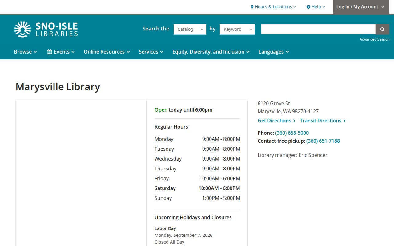
The branch is a local workspace; the State Library remains the verified directory holder. Confirm access before travel.
Place Marysville Homes in 1912
The 1912 Sanborn map dates streets and building footprints. It is a fire-insurance map, not a parcel survey. Compare it with legal descriptions, recorded plats, and modern GIS.
Marysville's grid assigns 100 numbers between cross streets and one number per 25 feet. State Avenue and Smokey Point Boulevard also split at 136th NE. Both facts can explain an old address mismatch.
Find Past Marysville Names in Print
The Historical Society museum library reports 1,146 digitized Marysville Globe issues across 129 cataloged years. Search OCR by surname, street variant, business, or event, then inspect the page image because OCR can fail.
A 28-page 1982 self-guided tour and 172-page Saunders history add context. Neither is a complete resident roll, but both can connect a site to local people and uses.
Marysville Records Split Over Time
Marysville began as a trading post in 1872 and incorporated in 1891 with about 350 people. The railroad arrived in 1892, the first City Hall opened in 1901, and the first public library followed in 1907. First Street was paved in 1914. The first Highway 99 route used Sunnyside Boulevard in 1916.
Those dates explain why previous residents appear across different custodians. A deed or plat may sit with the Snohomish County Auditor. City ordinances and permits follow the municipal trail. Newspapers and historical manuscripts record people and local uses. Directories may catalog Marysville inside an Everett volume, while census schedules sit in state or federal archives.
Do not infer that the 1909 Snohomish County Courthouse fire destroyed a specific Marysville file. The established fire date provides context, but the inspected official sources did not offer a series-by-series loss list. Check the actual custodian, microfilm, or archive for each missing item.
Keep the Marysville Parcel Stable
Street names and numbers can change, but a legal description provides a stronger bridge. It may refer to a recorded plat, lot, subdivision, or metes-and-bounds description. Current county and city GIS can add parcel geometry, site numbers, easements, rights-of-way, and annexation layers.
Three address terms must remain distinct. The situs address identifies the mapped site. A mailing address receives tax or other correspondence. The legal description identifies land. The Recorder searches parties, parcel, book and page, or legal language, while USPS deals with delivery labels. A Marysville ZIP can reach beyond city limits.
If an old street search fails, copy the current parcel and legal description, inspect the recorded plat, test both street-name forms, and compare the 1912 Sanborn map. This method tracks the land even when the words printed on a directory page have shifted.
Preserve Marysville Address Evidence
Save a citation for every link in the backward trail. For a deed, note the instrument number, date, parties, type, legal description, and image status. For a directory, record its exact title, year, page, city label, spelling, and abbreviation key. For a newspaper, save the issue date and page image, not only an OCR snippet.
The Recording Division offers downloadable unofficial copies. Certified copies are mailed and generally processed within five business days. Its fee list gives $1 per page for an unofficial copy and $3 for the first certified page plus $1 per later page. Certification proves the copy came from the custodian; it does not prove an owner lived on site.
When a file is not online, contact the office before concluding it is gone. Recording supports counter, phone, mail, and microfilm research. The Marysville Library supplies research equipment, while the Historical Society accepts research requests and maintains offline holdings beyond its web exhibits.
Search Marysville Census Households
The Washington Digital Archives' Snohomish County 1887 Census offers a rare structured source before Marysville incorporated. Its search fields include last, first, and middle name, Soundex, birthplace, and year range, plus a browse option. The collection reports 3,133 records. Results can include household names, age, marital status, birthplace, literacy, occupation, citizenship, and historical category labels.
Search a known surname first, then inspect nearby household members and the original context. Soundex can help with spelling shifts, but it should not replace image review. Some historic category terms require explanation and should not be repeated without a research reason. The census is open online, and microfilm is also held at the Washington State Library.
For the modern end of the public census trail, NARA's 1950 search covers Snohomish County under the federal 72-year rule. Match a likely household against its address, enumeration context, relatives, and age pattern. A shared surname alone is too weak. Census schedules add occupants and relationships that property deeds were never designed to record.
Test Marysville Civic Name Leads
The Marysville Historical Society's People collection indexes 480 names across specific civic roles. Its counts include 205 council members, 75 original voters, 65 incorporation petitioners, 22 postmasters, 32 mayoral terms, 88 festival queens, and seven first officers. These lists can place a person in Marysville civic life during a known period, but they are not complete population registers.
Use a civic index entry as a lead into dated newspapers, directories, deeds, census records, or probate. A council list may distinguish two people with the same surname. A postmaster or business reference may explain why an address appears in print. Still, the role itself does not show that the person lived in the property being traced.
The Society's museum library also has offline holdings and accepts research requests. Send a precise question with the street forms, date range, parcel or legal description, and known household names. That gives staff enough context to check files that are not represented by the online index.
Confirm Marysville Past Households
Owners are one layer. Directories and census schedules can add household context, though the catalog does not confirm a reverse section in each edition. The holdings appear on the Marysville city directory page.
- Choose the directory year nearest the deed or target date.
- Record title, year, page, city label, spelling, address, and abbreviation key.
- Compare the name with the next available edition.
- Pair it with the 1887 county or 1950 federal census when suitable.
- Use newspaper images and probate files to test relationships.
The 1887 Snohomish census reports 3,133 searchable records. NARA hosts the 1950 census under the 72-year rule. Probate belongs with the Superior Court Clerk. Together these can explain a change that deeds alone cannot.
Lawful use. Research previous residents for house history, genealogy, and lawful personal use. Never track, harass, or harm a living person.
Note: A taxpayer, deed party, permit contact, and occupant are different roles, even when one name appears in several sources.